







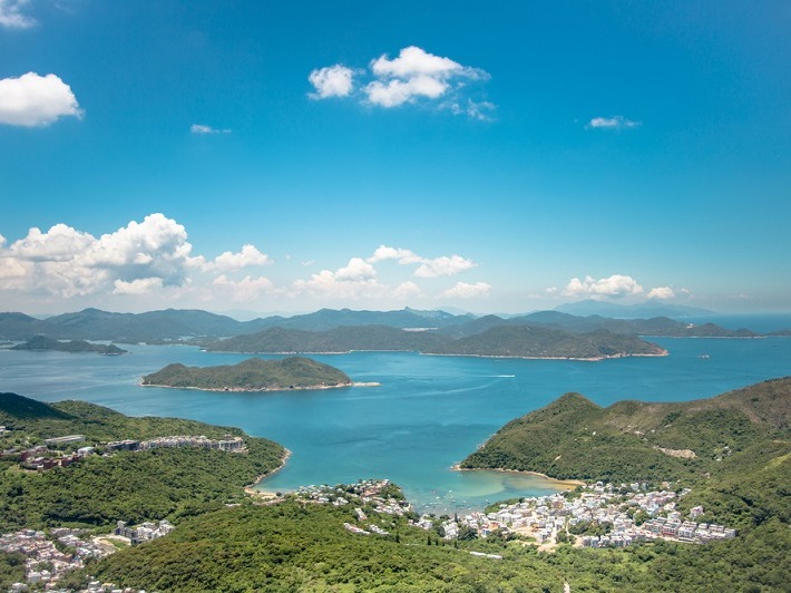
Why East Lantau is the best spot for reclamation




Why East Lantau is the best spot for reclamation

Authors: Wilfred Lau, Director of Aru
The debate over increasing land supply in Hong Kong has drawn a lot of public attention as the city is keen to find ways to ease its housing woes.
Land reclamation is obviously one of the most controversial options. Among proposals on reclamation made by local groups - from my perspective as an engineer - East Lantau is the most desirable location for major reclamation.
Our Hong Kong Foundation published a proposal recently for building an Enhanced East Lantau Metropolis (EELM), a 2,200-hectare artificial island in East Lantau, which is equivalent to half of the size of Kowloon, to accommodate 700,000 to 1.1 million people, as well as house new industries and recreational facilities.
Concerns have been raised over the proposal - notably about the ecological and environmental impact as well as connectivity. I was involved in the preliminary studies about the EELM.
Our studies show that the EELM is technically, financially and geographically feasible.
The studies reveal that the EELM does not intersect with the major habitats of the Chinese White Dolphins and the Finless Porpoises. The two species generally reside on the west of Lantau Island and the waters south of the EELM.
The studies also include contingencies to enhance ecological protection and preserve natural coastlines. A buffer of at least 200 meters will be maintained between the EELM and natural coastlines of Kau Yi Chau, Hei Ling Chau, Peng Chau and Sunny Island to protect indigenous species.
Non-dredging reclamation methods are also recommended as they are more environmentally friendly and will need comparatively less fill material. Geographically, the EELM is shielded by existing islands further south and therefore the height of the waves during typhoons is unlikely to exceed two meters.
In terms of technical difficulties of the proposed reclamation work, water depth at the EELM is about four to eight meters, which is comparable to other near-shore reclamation in Tung Chung, Tseung Kwan O and Chek Lap Kok.
The strategic location of the EELM also provides the site with possibilities of connectivity. The EELM is mid-way between Hong Kong Island and Lantau with many advantages: close to Central CBD, about five kilometers from Hong Kong Island West; enhanced connectivity to New Territories West; and proximity to the Greater Bay Area within a one-hour living circle.
The EELM can bring new transport links to enhance connectivity and relieve congestion in the whole city.
The studies suggest building three new railways connecting the EELM to Kennedy Town, Mei Foo and the future Tuen Mun South Station. This would form a closed-loop design in Hong Kong's railway network and help relieve traffic congestion in the New Territories West.
Residents of New Territories West - Tuen Mun and Tin Shui Wai - have long suffered from serious congestion especially in the morning peak hours.
The West Rail Line of the Mass Transit Railway has already reached its design capacity, while Tuen Mun Road congestion now starts around an hour earlier at 7am compared with 10 years ago.
With the connections of the EELM railway at Mei Foo Station and the future Tuen Mun South Station, a "loop" will be formed between the EELM railway and West Rail, which will provide an alternative to West Rail passengers, in particular those in the Tuen Mun area trying to access Hong Kong Island.
Initial estimates show that peak-hour passenger trips on the West Rail could potentially be reduced by 10 percent to 15 percent.
For road traffic, the EELM could also be connected to mainland China and the rest of Hong Kong through three major road links - one connecting to Kennedy Town, another to the Lantau Link and a third stretching to Mui Wo and then to Tuen Mun and the Hong Kong-Zhuhai-Macau Bridge.
These new road links could alleviate congestion in the three cross-harbor tunnels.
The strategic location of the EELM could also strengthen Hong Kong's leadership position in the Greater Bay Area. The EELM is at the core to connect to the nine cities in the Greater Bay Area through the Hong Kong-Zhuhai-Macau Bridge.
Commuting to cities like Hengqin, Zhuhai or Foshan will take no more than an hour by high-speed railway.
Only large-scale reclamation can create the foundations to bring a new vision to Hong Kong's development. The EELM's strategic location in East Lantau makes it the most desirable option.


Authors: Wilfred Lau, Director of Aru
The debate over increasing land supply in Hong Kong has drawn a lot of public attention as the city is keen to find ways to ease its housing woes.
Land reclamation is obviously one of the most controversial options. Among proposals on reclamation made by local groups - from my perspective as an engineer - East Lantau is the most desirable location for major reclamation.
Our Hong Kong Foundation published a proposal recently for building an Enhanced East Lantau Metropolis (EELM), a 2,200-hectare artificial island in East Lantau, which is equivalent to half of the size of Kowloon, to accommodate 700,000 to 1.1 million people, as well as house new industries and recreational facilities.
Concerns have been raised over the proposal - notably about the ecological and environmental impact as well as connectivity. I was involved in the preliminary studies about the EELM.
Our studies show that the EELM is technically, financially and geographically feasible.
The studies reveal that the EELM does not intersect with the major habitats of the Chinese White Dolphins and the Finless Porpoises. The two species generally reside on the west of Lantau Island and the waters south of the EELM.
The studies also include contingencies to enhance ecological protection and preserve natural coastlines. A buffer of at least 200 meters will be maintained between the EELM and natural coastlines of Kau Yi Chau, Hei Ling Chau, Peng Chau and Sunny Island to protect indigenous species.
Non-dredging reclamation methods are also recommended as they are more environmentally friendly and will need comparatively less fill material. Geographically, the EELM is shielded by existing islands further south and therefore the height of the waves during typhoons is unlikely to exceed two meters.
In terms of technical difficulties of the proposed reclamation work, water depth at the EELM is about four to eight meters, which is comparable to other near-shore reclamation in Tung Chung, Tseung Kwan O and Chek Lap Kok.
The strategic location of the EELM also provides the site with possibilities of connectivity. The EELM is mid-way between Hong Kong Island and Lantau with many advantages: close to Central CBD, about five kilometers from Hong Kong Island West; enhanced connectivity to New Territories West; and proximity to the Greater Bay Area within a one-hour living circle.
The EELM can bring new transport links to enhance connectivity and relieve congestion in the whole city.
The studies suggest building three new railways connecting the EELM to Kennedy Town, Mei Foo and the future Tuen Mun South Station. This would form a closed-loop design in Hong Kong's railway network and help relieve traffic congestion in the New Territories West.
Residents of New Territories West - Tuen Mun and Tin Shui Wai - have long suffered from serious congestion especially in the morning peak hours.
The West Rail Line of the Mass Transit Railway has already reached its design capacity, while Tuen Mun Road congestion now starts around an hour earlier at 7am compared with 10 years ago.
With the connections of the EELM railway at Mei Foo Station and the future Tuen Mun South Station, a "loop" will be formed between the EELM railway and West Rail, which will provide an alternative to West Rail passengers, in particular those in the Tuen Mun area trying to access Hong Kong Island.
Initial estimates show that peak-hour passenger trips on the West Rail could potentially be reduced by 10 percent to 15 percent.
For road traffic, the EELM could also be connected to mainland China and the rest of Hong Kong through three major road links - one connecting to Kennedy Town, another to the Lantau Link and a third stretching to Mui Wo and then to Tuen Mun and the Hong Kong-Zhuhai-Macau Bridge.
These new road links could alleviate congestion in the three cross-harbor tunnels.
The strategic location of the EELM could also strengthen Hong Kong's leadership position in the Greater Bay Area. The EELM is at the core to connect to the nine cities in the Greater Bay Area through the Hong Kong-Zhuhai-Macau Bridge.
Commuting to cities like Hengqin, Zhuhai or Foshan will take no more than an hour by high-speed railway.
Only large-scale reclamation can create the foundations to bring a new vision to Hong Kong's development. The EELM's strategic location in East Lantau makes it the most desirable option.